Enchanted Rock
State Natural Area, Texas Parks & Wildlife
Chef Emile's Enchanted Rock, Loop Trail Log
January 25 -26, 2006
OK, I have learned, Bring a camera (and remember to take pics!!) I was in the parking lot and looked at my cellular signal, NONE!!! SOOOO, I left it in the truck!!! DUMB! Because I use my cell phone as my camera!! The couple of pics are from my Treo 650, that I took after the hike.
The official map is fantastic! The topography lines are of great help because they are in increments of only 20 feet! I have annotated the hike in red and made some notes.
This hike and overnight camping was a solo experience,
except for my puppy, Ticks. I packed some FEMA MREs, water, and some smoked
sausage that I had purchased in Fredricksburg. For lodging I had a really great
popup tent and sleeping bag.
I took the Loop Trail clockwise around the base of Little Rock and towards the back of Enchanted Rock. Along the way there are several fantastic rock formations. These are not shown on the map, but are a welcome treat to see. Enchanted Rock is made of a reddish granite, but there are several types of out-croppings of white quartz and other colors of granite.
The Loop Trail intersects with Echo Canyon Trail near Moss Lake. I don't know if you would call this a lake, more like a pond.
 That night I camped out in the Primitive Area near by. It
is nicely wooded with plenty of bird life and deer markings. (I didn't see and
deer, though) The ground here is level with plenty of underbrush to make a soft
and dry bottom for the tent. The compost toilet was a good .25 mile away, not
good!
That night I camped out in the Primitive Area near by. It
is nicely wooded with plenty of bird life and deer markings. (I didn't see and
deer, though) The ground here is level with plenty of underbrush to make a soft
and dry bottom for the tent. The compost toilet was a good .25 mile away, not
good!
Ticks and I had a nice night, it even sprinkled a little.
In the morning I packed up and decided to take the Echo Canyon Trail back to the
parking lot. This is a trail leads southeast between Enchanted Rock and Little
Rock.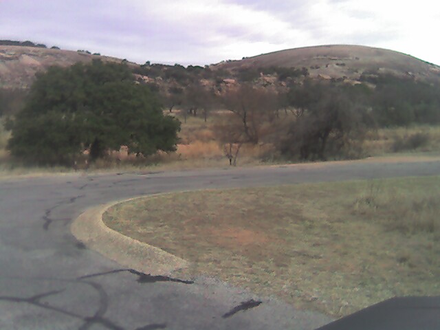
WELL, I missed the intersection of the Summit Trail and Echo Canyon, and found myself and dog, right at the hump between the two ROCKS!! (Mountains to me!!) I had to come down pack, dog and all; on my butt!! About a height of 120 feet.
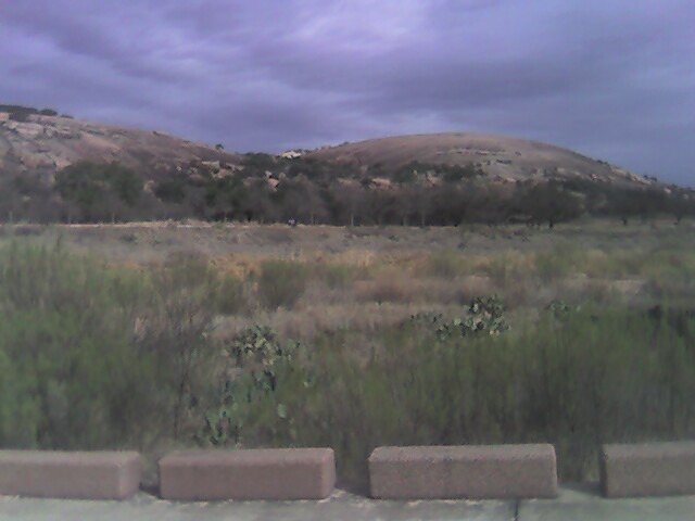
Here are the pics, taken after the hike from the parking lot.
I gotta go back and do it right next time!
OK, I did!!! Check out my Loop Trail Log from Christmas Eve, December 24, 2007
Contact us for further details....notactive@customcatering.net
![]() to
Home Cookin' Page
OR
to
Home Cookin' Page
OR
![]() to Hiking Trail Log Page
to Hiking Trail Log Page![]()
Chef Emile L. Stieffel, Aurora Catering, Inc. email
address: notactive@customcatering.net
4016 Red Cypress Dr., Harvey, LA 70058 Phone (504)
-329-1344
Copyright © 1995 - 2006 [Aurora Catering, Inc.]. All
rights reserved.
Revised: December 20, 2011.