Pecan Grove, Ring Levee, and
Wood Duck Trails
Jean Lafitte National
Historical Park and Preserve
Barataria Preserve
Chef Emile's
Pecan Grove, Ring Levee, and Wood Duck Trail Hiking Log
May 16, 2007
 The
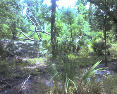
day was overcast with just a few moments of sunshine. Also it had rained the
prior two days so the ground was mushy (swamps usually are). I say this
because if you are looking to take these trails, normal hiking boots just won't
do, you need to get some Chalmette Wedding Boots or Shrimp Boots!
 Well, that is what we call them down here, basically, they are white wading
boots. You can get them from
(Alario Brothers Marine Supplies Inc, 894 Avenue A
Westwego, LA (Louisiana) 70094-4230......Phone: (504) 341-1843),
in Westwego and cost under $25 bucks.
From the Pecan Grove you go about 4/10s of a mile
northeast. On my marked up
park's map, It is not labeled with a name except Loop A and is a part of the
Plantation Trail. Anyway you come to a point where the Plantation Trail heads
off northwest, the Ring Levee trail leads north, the Wood Duck trail heads east
and The Old Plantation trail follows southeast. Plenty of directions to
choose to go! See my Plantation Trail Log
Notes of Loops A & B. But for this hike I took the Ring Levee Trail.
Ring Levee and Plantation Trail Log Notes and Map
The above is a Google generated map made by the trailpoints reordered by my
Garmin GPSMAP 76CSx. I would suggest clicking on the Hybrid map and
zooming in.
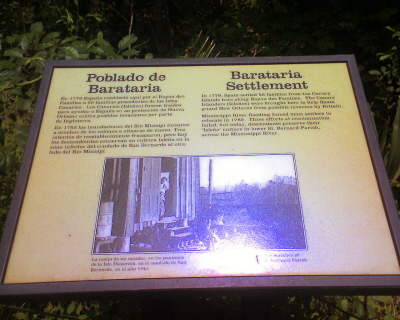 This
is the
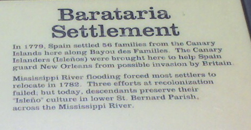 plaque
that is at the beginning of the Ring Levee Trail, the blow up talks about the
Canary Islanders that were brought here by the Spanish Governor Galvez in 1779.
My ancestor, Juan Raimoundo Garcia settled here. So, it was pretty cool to see
that they were remembered here. There was also a paper sign that said that
the trail was closed for repairs. Well that didn't stop me, I just kept on down
the trail.
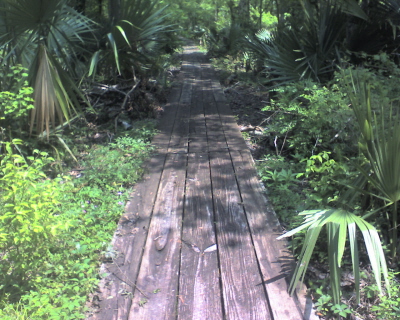 The
trail is a built similar to the Kenta Canal Marsh
Overlook Trail, BUT..... is just a couple of inches from the water level.
That is great because lizards run up and down the walkway! This was also my
first hike with my Garmin GPSmap 76CSx so if you want to check out my route just
click
here!
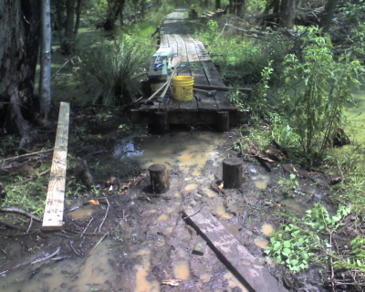
I hiked 1/2 mile then came upon the above construction. Now
I know why the trail was closed! I only had on tennis shoes so, that was
the end of the trail for me. Well, not really, You have to back track the
walkway.
From what I have read about the trail, it ends at a site
that had some oil drilling in the '60s, and a "ring" levee was built around the
drill site. Well, I gotta come back to this one and check it out.
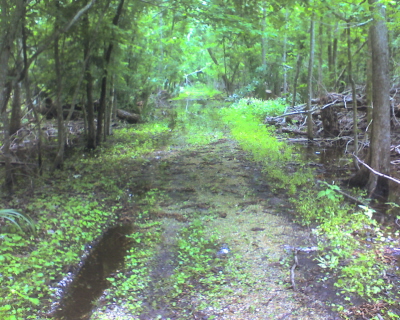 I
then doubled back to the middle of the fork and took the Wood Duck Trail for
about 1/4 mile, it leads in an Easterly direction. This trail has no built up
walkway, and again it was very marshy and muddy, I needed shrimp boots, so next
time I will be ready! But along the way I saw the biggest wood pecker I have
ever seen. It was red, white and black! There is life everywhere, in the
trees, running along the ground, and in the water.
Contact us for further details....ChefEmile@CustomCatering.net
 to
Home Cookin' Page
or
 to Hiking Trail Log Page

Chef Emile L. Stieffel, Aurora Catering, Inc.
email address:
ChefEmile@CustomCatering.net
4016 Red Cypress Dr., Harvey, LA 70058 Phone (504) -329-1344
Copyright © 1995 - 2007 [Aurora Catering, Inc.]. All
rights reserved.
Revised: December 20, 2011.
 The
day was overcast with just a few moments of sunshine. Also it had rained the
prior two days so the ground was mushy (swamps usually are). I say this
because if you are looking to take these trails, normal hiking boots just won't
do, you need to get some Chalmette Wedding Boots or Shrimp Boots!
 Well, that is what we call them down here, basically, they are white wading
boots. You can get them from
(Alario Brothers Marine Supplies Inc, 894 Avenue A
Westwego, LA (Louisiana) 70094-4230......Phone: (504) 341-1843),
in Westwego and cost under $25 bucks.
 This
is the
 plaque
that is at the beginning of the Ring Levee Trail, the blow up talks about the
Canary Islanders that were brought here by the Spanish Governor Galvez in 1779.
My ancestor, Juan Raimoundo Garcia settled here. So, it was pretty cool to see
that they were remembered here. There was also a paper sign that said that
the trail was closed for repairs. Well that didn't stop me, I just kept on down
the trail.
 The
trail is a built similar to the
 I
then doubled back to the middle of the fork and took the Wood Duck Trail for
about 1/4 mile, it leads in an Easterly direction. This trail has no built up
walkway, and again it was very marshy and muddy, I needed shrimp boots, so next
time I will be ready! But along the way I saw the biggest wood pecker I have
ever seen. It was red, white and black! There is life everywhere, in the
trees, running along the ground, and in the water.