
Palo Duro Canyon
State Natural Area, Texas Parks & Wildlife
Chef Emile's Lighthouse Trail Log
October 22, 2006
![]()
In October of 2006 I helped cater the inauguration of my great
friend El Presidente' Pat O'Brien at WTAMU. Go Buffs!!! ...... So, after the catering is done, then
it is time to play (well hike in this case)!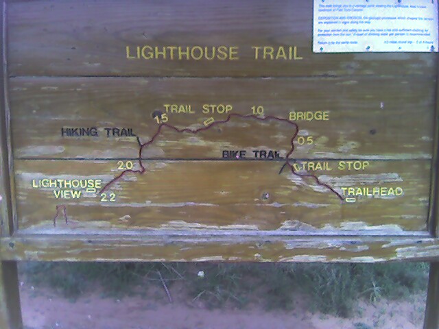
These are from the Texas State Park, Palo Duro (Spanish for Hard Wood). This is the official park map that I have annotated and made a couple of notes. The park's map and Trailhead wood map are not accurate. Neither show that at the end of the hike, you have to climb a canyon wall!! And I think that the mileage is off. Also, there are no topographic lines on the park's map.
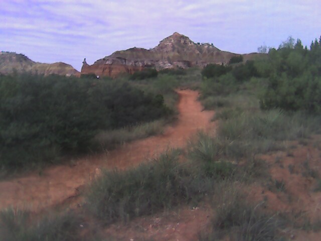
I took the Lighthouse Trail, it a fantastic hike, mostly along the canyon flatbed that meanders about 2.2 miles towards the Lighthouse. You can see it in the distance, COOL. But then you hike another half mile or soooo, and up the side of the canyon walls several hundred feet!! They don't show you on the board here, but it is on the official park map.
This is SOOOOO Cool! Along the trail, you walk, I would
guess, 180 degrees around the the base of this formation.
 I
called the park ranger's office and he said that he didn't know if this
formation had a name!! I told him it looked like a Teepee, so that is what I am
going with! "The Teepee" or sometimes spelled "Tipi".
I
called the park ranger's office and he said that he didn't know if this
formation had a name!! I told him it looked like a Teepee, so that is what I am
going with! "The Teepee" or sometimes spelled "Tipi".
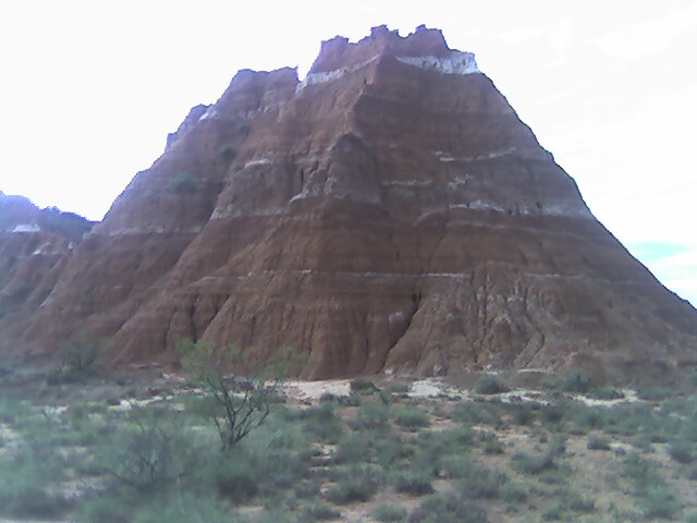
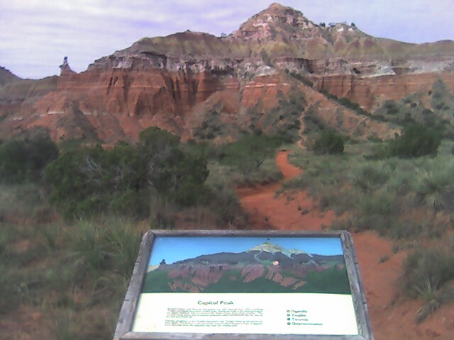
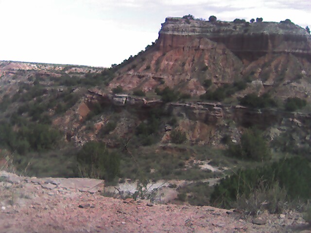
This is Capitol Peak at a distance. At first I thought that the formation on the left would be the Lighthouse, but it wasn't.
This is Capitol Peak, like I said at first you think that
the formation on the left is the Lighthouse but as you get this close you can
see it isn't, I think it is called the Chimney.
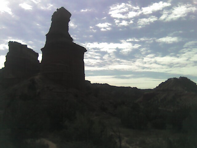
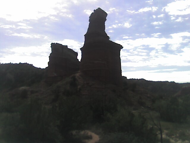
This is the Lighthouse at a distance! It looks small, but
you are about 3/4s of a mile away!

The trail is fantastic, you walk along the canyon bottom, you have seen the Lighthouse at a distance, then you get the realization that you have to climb up the side of this canyon wall!! OMG! I think this is the right picture, I hope so.

As you climb up the canyon wall, there are some wooden steps that are made with 4X4's, they have rebar driven into the ground to help secure them, BUT, they are somewhat wobbly! You have to be real sure footed, and I am NOT!! So, I climbed up sort of on all fours. It is really steep! And if you look down, it is a lot scary!
Finally, this is a view from the top, looking back down into the canyon that I was in! I made it to the top!! WOW!!

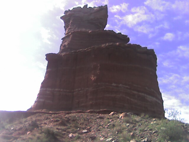
Now, just a couple of more steps, over some boulders, and this is what you see! The sort of, back side of the Lighthouse! There is a bench there, THANK GAUD! I took these pics from the bench. The structure behind the Lighthouse is unnamed, the park ranger said that both structures were part of the Lighthouse.
Then you have just, a couple of hundred feet, down, and up to the base of the Lighthouse. From the pics on brochures, this is the back of the Lighthouse.
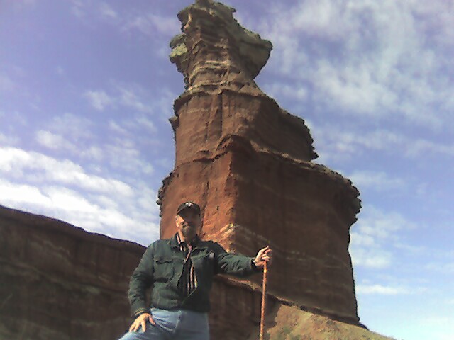
You can walk around it, and climb on that first plateau.
I MADE IT!!!
This is taken, from where I am standing in the above pic, you see across the bottom of the canyon, and looking at another canyon wall! This formation is east northeast of the Lighthouse and is called Castle Peak.
Some pics along the trail. One of the things I have learned that you don't always look behind you!! This is an "up and back" trail. There were so many formations that I noticed on the return trip that I did not notice before!
I don't know if this formation has a name, but it was very impressive!

This is one of the canyon walls that you get to see. It is really that sharp looking! The top of the walls looked so surreal against the clouds. WOW! I have seen this ridge in some of the Texas brochures, and it that fantastic! The pic was taken on the walk back, I saw the ridge line on the way to the Lighthouse, as the clouds moved it, they completely changed the feel of the scene. And I think this is the other side of the formation of the second picture above.

This is the back side of the "Teepee", I am calling it Shark's Jaw Ridge!!
As you can see it is a GREAT hike!! The only thing I would love for them to do is fix the map!!!
Contact us for further details....notactive@customcatering.net
Chef Emile L. Stieffel, Aurora Catering, Inc. email
address: notactive@customcatering.net
4016 Red Cypress Dr., Harvey, LA 70058 Phone (504)
-329-1344
Copyright © 1995 - 2006 [Aurora Catering, Inc.]. All
rights reserved.
Revised: December 20, 2011.